A final report was published on the last month for documentation of a Roman milestone near Horbat Mishkena that was held in January and March 2017, in the wake of antiquities robbery and development work. The documentation was conducted by IAA employees.
Horbat Mishkena lies on an elongated spur-like hill in the east of the Tur‘an Valley, c. 1 km north of the Golani Junction. The eastern part of the site contains a burial ground, with the main settlement area located to its west. The Roman Ptolemais (Akko) – Diocaesarea (Zippori) – Tiberias road passed to the south of the site. Over the years, sections of this road were uncovered around the Golani Junction (nowadays intersection).
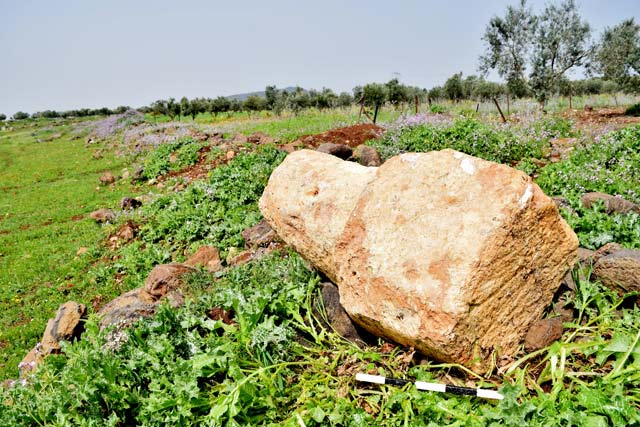
This milestone was recorded in the Israeli Milestone Committee Archive (IMC) and signed the number 693, and today is found at the IAA warehouse in Katzrin. In the 1970′ Another milestone was found close to IMC 693, signed in the IMC Archive as IMC 288 and found today at the courtyard of Beit Gordon Museum in Degania A.
The Milestone in this report (IMC 693) was found left lying on a bank of stony soil, c. 500 m southeast of Horbat Mishkena (map ref. 239157/742955). The stone’s upper part is broken, and it has a rectangular base (0.4 × 0.7 m, height 0.55 m) surmounted by a conical pillar (base diam. 0.6 m, height 0.55 m); no inscription is visible.
Distelfeld, N. Klein, E. Silberklang, H. Horbat Mishkena, Hadashot Arkheologiyot 134 (2022)