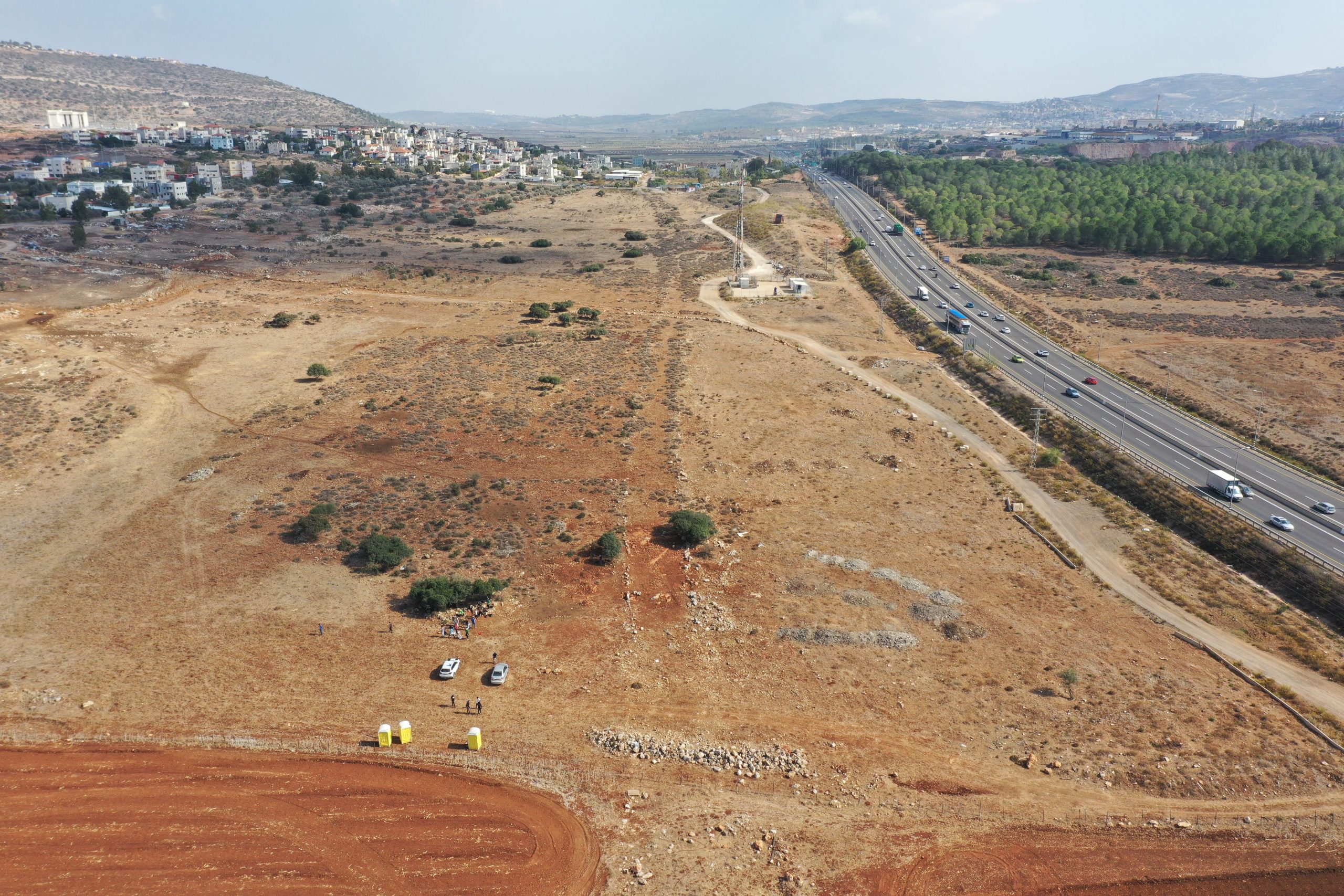
From summer 2022 till winter 2023 a study excavation was conducted on the Diocaesarea-Tiberias Roman road near the village of Rumat al-Heib.
The excavation, undertaken by the Israel Antiquities Authority, was directed by H. Mamalya and D. Weinberger (we thank H. Mamalya for the information and photos from this excavation, prior to the scientific publication).
The excavation was conducted over 300 square meters and exposed a 30 m. segment of the road that was part of the Imperial-Roman road network from Ptolemais (Akko) to the Empire’s East.
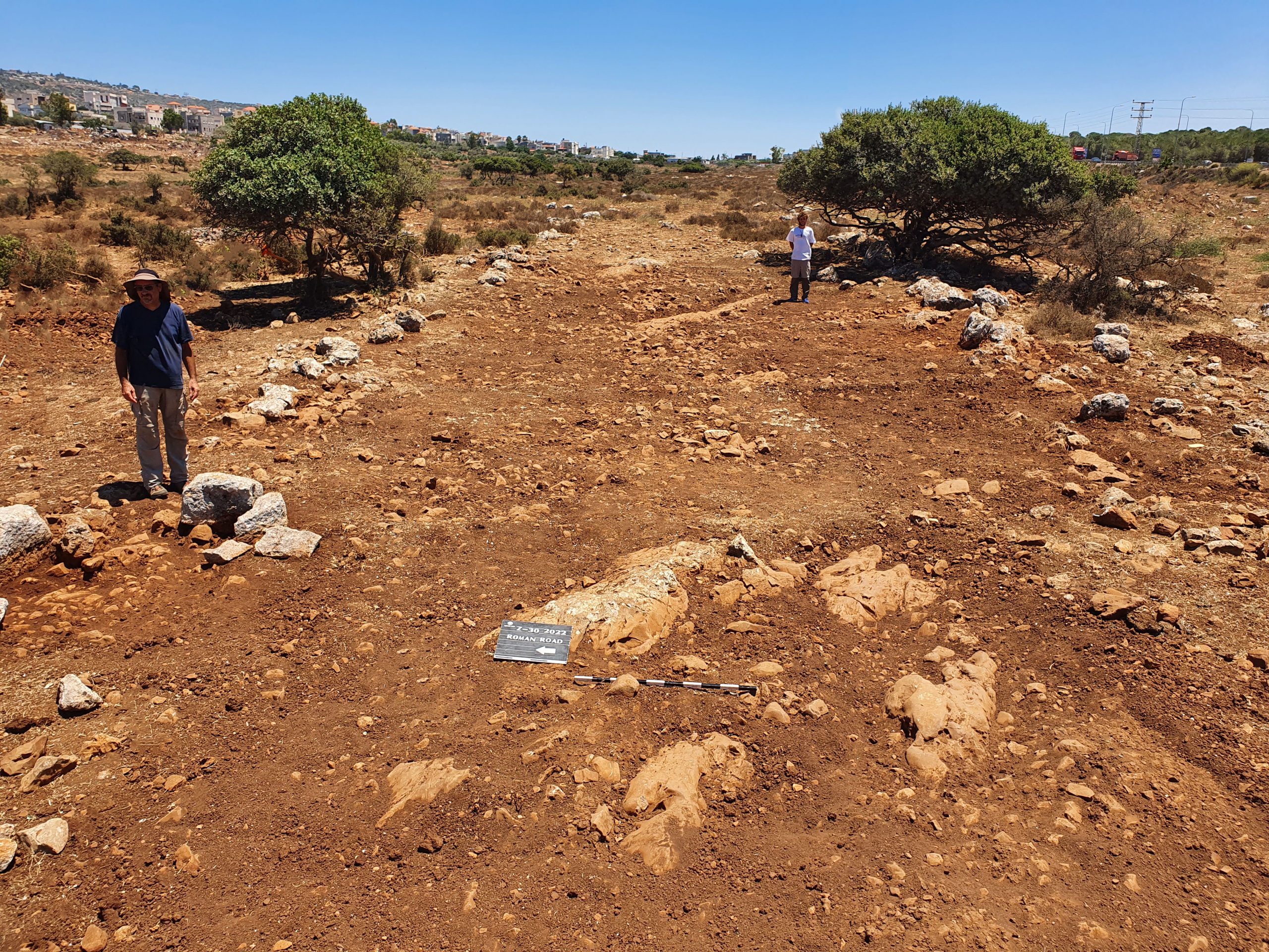
The width of the excavated road segment was revealed – ca. 10 m., wasn’t paved and its construction was defined with 2 rows of limestone rocks partly carved, functioned as sideways (see attached photos – taken by the excavators). The road infrastructure contained compacted soil to overcome the topographic bumps that were made by the natural bedrock. In some points it seems that the road strip was widened, due to the points where the natural bedrock stood up significantly from the road level till it became an obstacle for transportation movement. The excavators believe that these points functioned as ‘Traffic Islands’.
On the northern side of the road a round stone base and a carved stone ca. 1.2 m. height – according to the excavators a possible Roman Milestone. Despite a scant find of pottery, it was made possible to date the activity at the site to the Roman period.
The Roman road between Diocaesarea and Tiberias was studied before, but not fully published. Close to the current excavation, the IMC survey recorded in the 1980′ and 1990′ the 2nd milestation from Diocaesarea (Zippori) with 4 milestones, one of them with a Latin inscription from Caracalla’s reign. Another segment from this road is still visible in the surroundings of Horbat Mishkena and Golani interchange, where 2 milestones were discovered.
Further reading:
Alexandre, Y. Horbat Mishkena – Es-Sire (B), Hadashot Arkheologiyot 124 (2012)