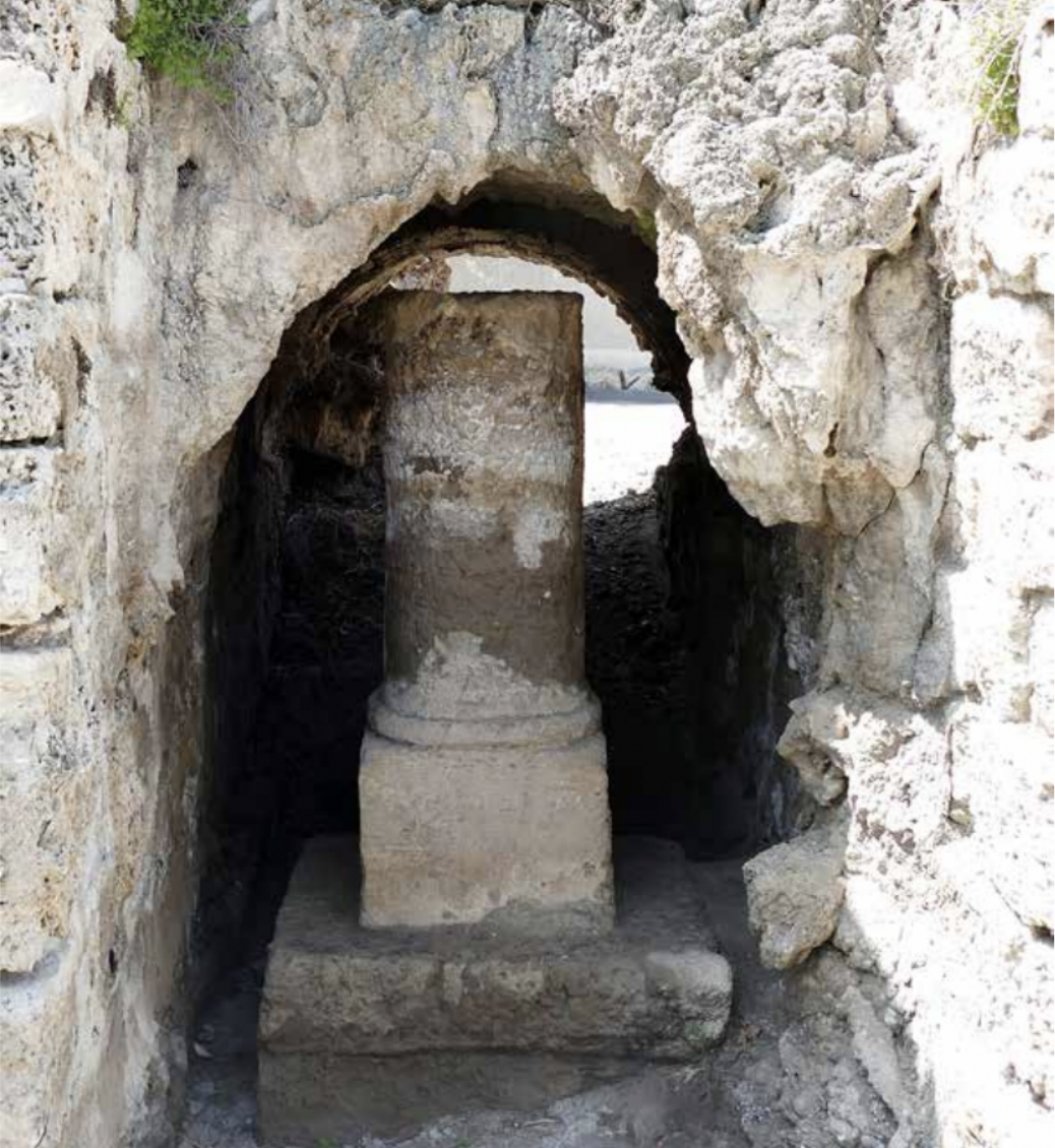
A milestone with an inscription dating back to the time of the emperors Marcus Aurelius and Lucius Verus (161-169 AD) was recently discovered and scanned.
This milestone was found beneath one of the Roman arches of the high aqueduct leading to Caesarea. In a recent article published in the journal “‘Atiqot,” the authors (Ecker, Tepper, and Karasik) highlight that the new 3D scan of the stone enabled them to solve a puzzle that had remained unsolved for decades. The milestone, previously cataloged as IMC 509 by the Israel Milestone Committee, had several suggestions regarding its use and original location over the years (Roll 1996, Roll 2011, Tepper 2011, Porat and Ad 2015). However, the comprehensive scan conducted by the researchers confirmed that the pillar is indeed a milestone, leading to a discussion on its integration into the Roman road system in the region.
Upon deciphering the inscription and considering the stone’s original placement, the researchers propose that it marked a mile station on the road between Caesarea and Legio. This milestone likely predates the construction of the road section further south leading to Legio. Interestingly, the proposed road section eventually submerged underwater due to the construction of dams in Nahal Taninim in the fourth century AD.
Further reading:
Ecker, A. Tepper, Y. and Karasik, A. A Milestone Without A Road: A Distance Marker Below an Arch of the High Aqueduct to Caesarea, ‘Atiqot 110 (2023), pp. 129-148